Material-Semantic Consolidation for Web-Ready Planning
A Workflow from Rhino to ArcGIS with Grasshopper
In collaboration with Muyun Xiao, Shangde Gao, Changjie Chen
INTRODUCTION
Bringing together detailed building design models and city-scale mapping technology enables a more precise evaluation of the impacts of design, supports data-driven decision-making, and promotes clearer communication among architects, planners, and various stakeholders.
However, this integration of the two domains remains challenging because architectural design and urban planning usually function as distinct ecosystems with different data structures and intended applications. Specifically, architectural tools such as CAD or BIM software can produce highly detailed building models, which are often organized into fragmented hierarchies of thousands of components. While suitable for design exploration, these models are computationally demanding and frequently lack explicit semantic attributes, such as material type, functional category, or structural role, that would support interpretation in external platforms. By contrast, urban planning relies on GIS platforms, which are optimized for managing spatial data at city and regional scales and incorporating geospatial context, regulatory constraints, demographic information, and infrastructural networks. Importing architectural models into GIS often fails because GIS is not fully designed to process the level of detail or fragmented hierarchies of architectural models, limiting communication between architects and planners.
Several strategies have emerged in response to this challenge. One line of research has focused on geometry reduction, which reduces the level of detail to make architectural models easier to render within city-scale visualization platforms. However, geometry reduction may lose the distinctions between materials, structural systems, or functional components, making architectural models visually simplified but semantically unclear.
Another line of research focuses on structured BIM-to-GIS data exchange, where architectural models are translated into geospatial formats using standards. Such a workflow aims to preserve not only geometry but also the metadata associated with building components. While BIM-to-GIS data exchange methods can achieve greater semantic accuracy than geometry reduction, they are typically complex, requiring specialized software, custom scripting, and substantial preprocessing.
This study proposes a data standardization method that streamlines the translation of Rhino architectural models into web-ready ArcGIS mapping 3D scene layers. Our approach consolidates different architectural components into a small number of meshes based on material, achieving a balance between geometric efficiency and the preservation of material clarity. Through four test buildings, we demonstrate that the proposed workflow can improve the accessibility and interpretability of architectural design models within urban planning contexts.
METHODOLOGY
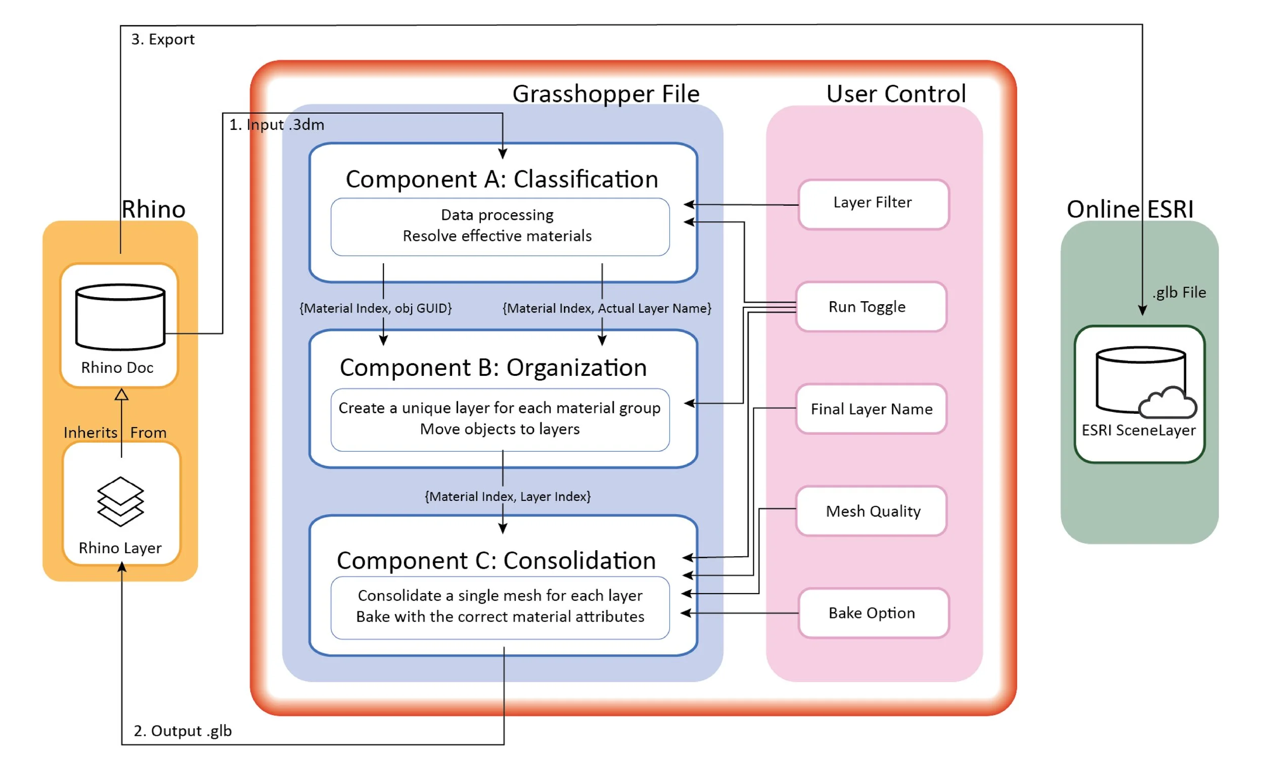
In consideration of accessibility and convenience for users from various backgrounds and with different levels of computer skills, we propose a custom Grasshopper Python script that restructures complex architectural models into web-ready meshes grouped by material and exported as files suitable for online visualization. As shown in the data flow diagram (Fig. 1), the Grasshopper file is composed of three parts: classification, organization, and consolidation. We designed the three-component workflow to ensure separation of concerns while also providing users with intermediate controls and opportunities for adjustment. The classification component scans all objects in the active Rhino document, records the material assigned to each object, and maps it to the object’s digital information.
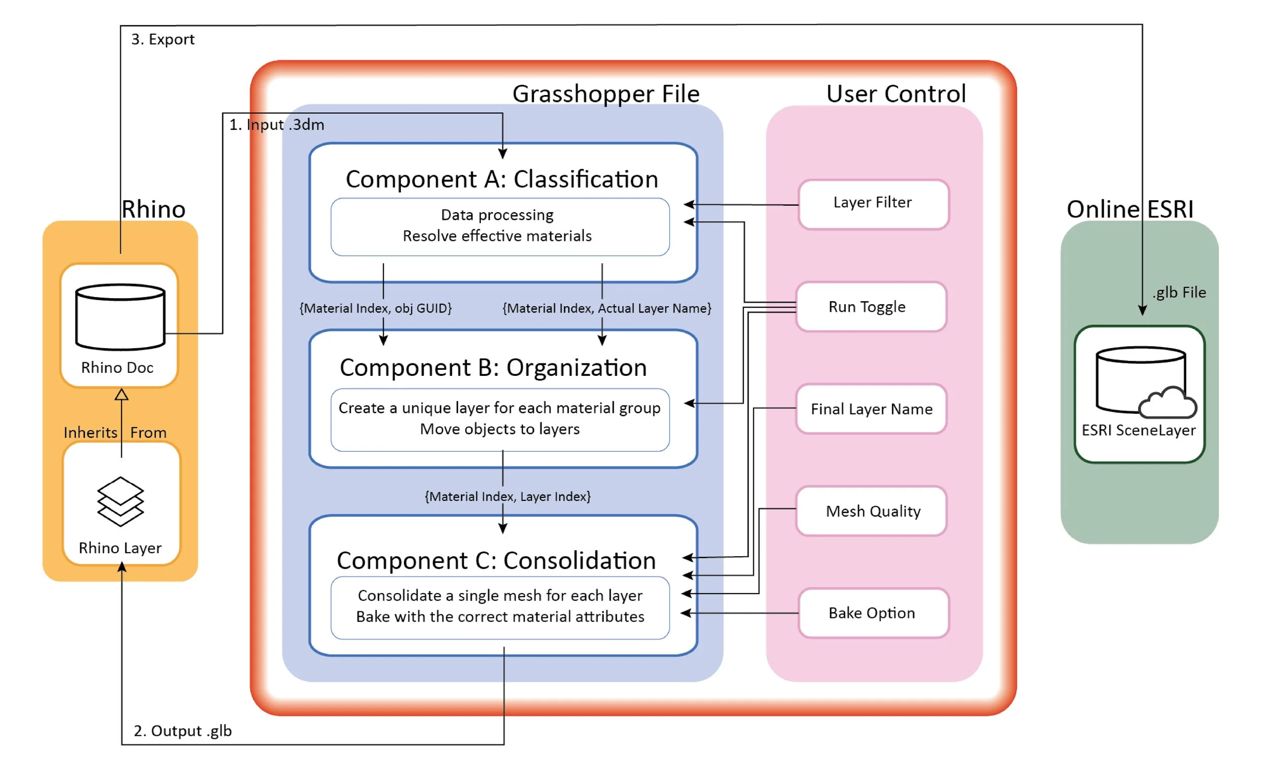
FIGURE 1: The proposed workflow with data transferring
The organization component creates temporary layers for each unique material index and moves the corresponding objects onto the correct layers. This stage allows users to pause and manually inspect or verify the material groups and even adjust the material textures.
The final consolidation component uses the layer organization from the previous stage to iterate through each material group. For each material, all objects are gathered and converted into a single joined mesh. Users can customize both the output mesh quality and the final output layer name, which collects all joined meshes from the material layers. At this stage, users can view the consolidated output meshes appearing on a separate layer, ready to be exported and loaded into GIS platforms.
RESULTS
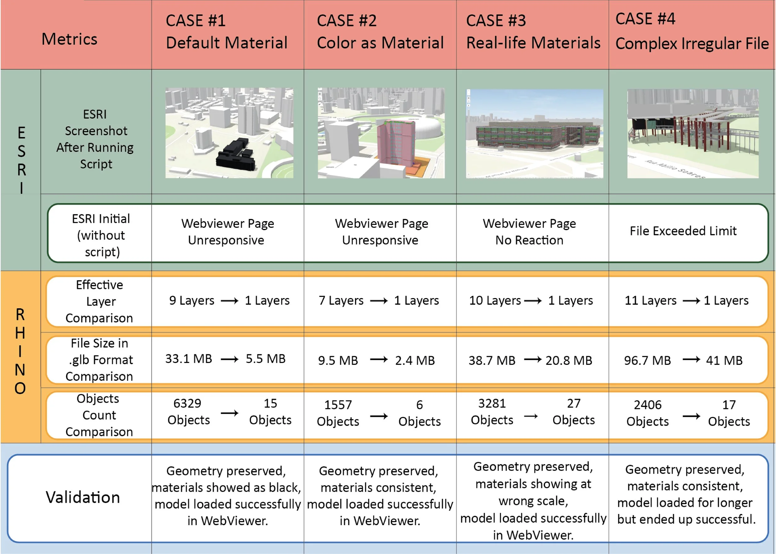
Our method solves problems of ineffective loading of unprocessed building files. To evaluate the proposed workflow, we tested it with several different Rhino building models, of which four representative cases are listed in Fig. 2, varying in levels of complexity and material selections. We started with the most basic Rhino model, Case #1, which has a normal file size and no materials applied to objects, and then proceeded to models with materials applied through colors, real-life material renderings, and, finally, complex curved shapes.
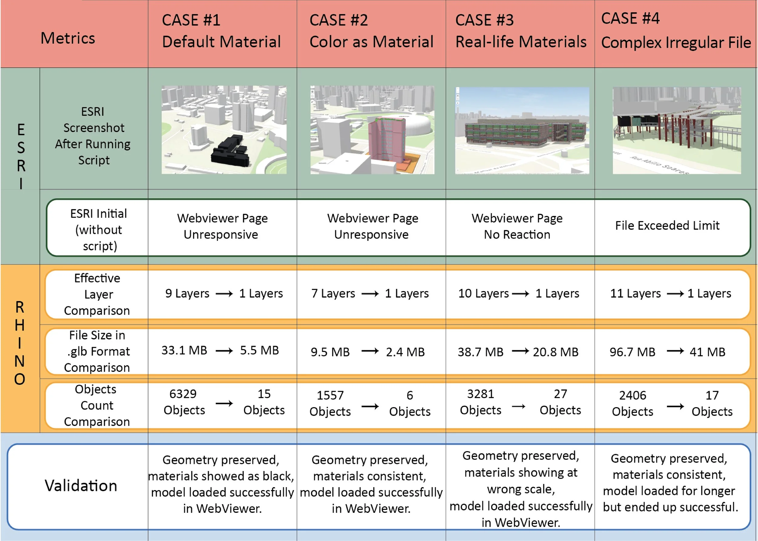
FIGURE 2: Results of cases using the proposed workflow
As shown in Fig. 2, the methodology consistently demonstrated a massive reduction in geometric complexity and data size while preserving geometry and material integrity, averaging a 53% reduction in file size and an average object count reduction by a factor of 180:1. ArcGIS Scene Viewer performance improved dramatically, with previously unresponsive or oversized files becoming viewable and navigable. These optimized 3D models can be readily incorporated into larger 3D city models, supporting contextual visualization, multi-scale analysis, and collaborative design evaluation.
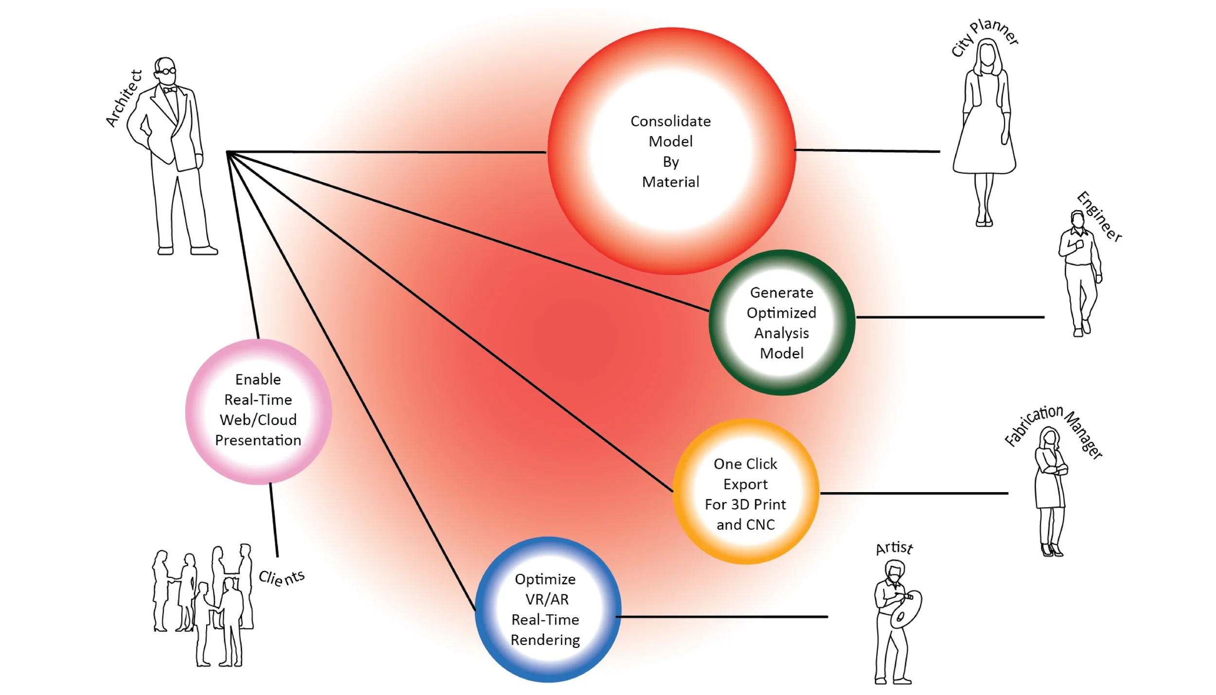
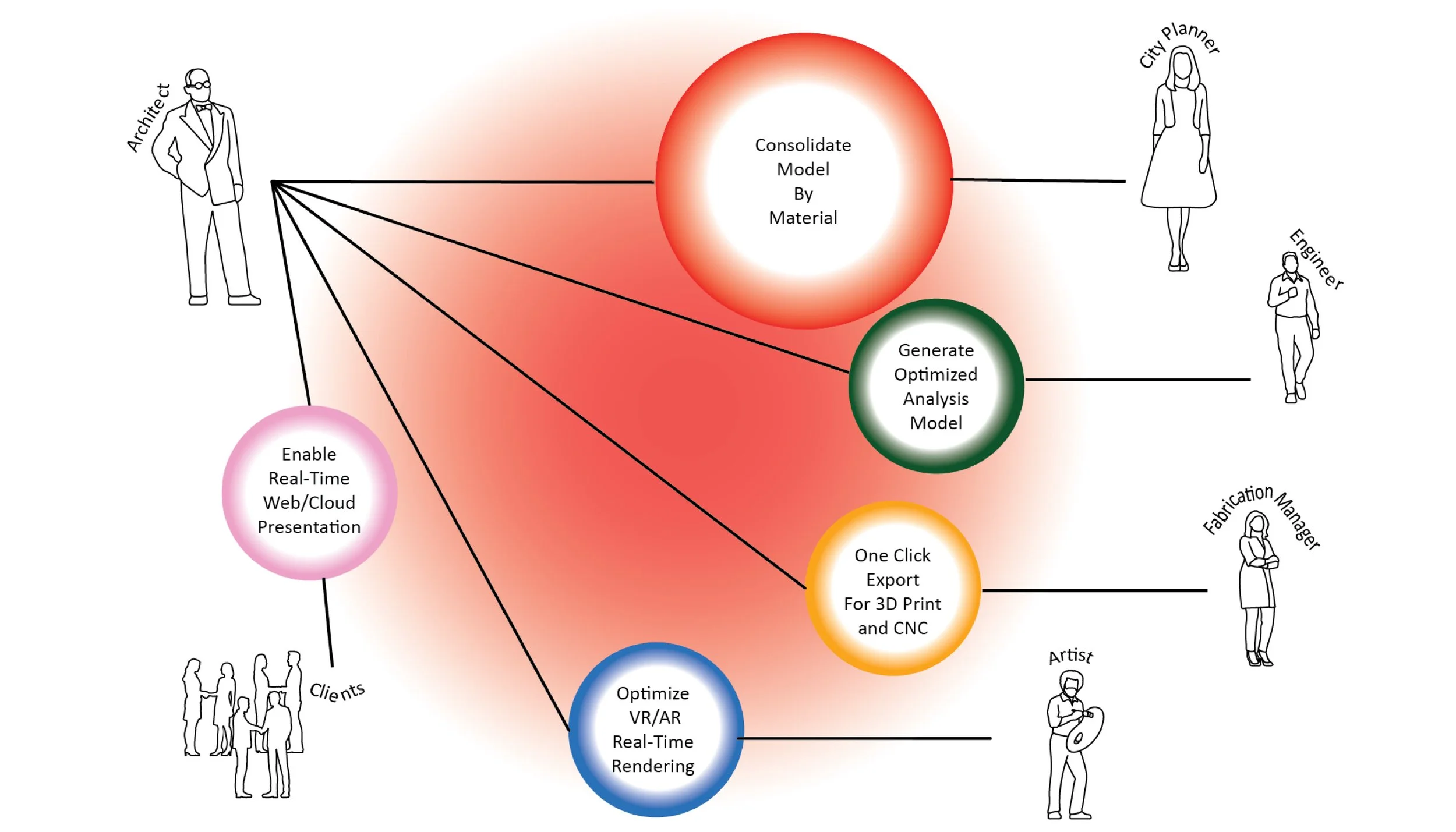
FIGURE 3: Collaboration among stakeholders with the output of the proposed workflow
Conclusion and Discussion
The proposed methodology bridges the long-standing gap between architectural design and GIS-based 3D city modeling (Fig. 3) through a standardization script. By restructuring Rhino models into web-ready, material-grouped meshes, the method makes complex architectural files both lighter and semantically legible. This shared accessibility not only accelerates communication but also enhances decision-making by allowing stakeholders to interact with a common data platform, fostering open, transparent, and collaborative engagement among diverse stakeholders.
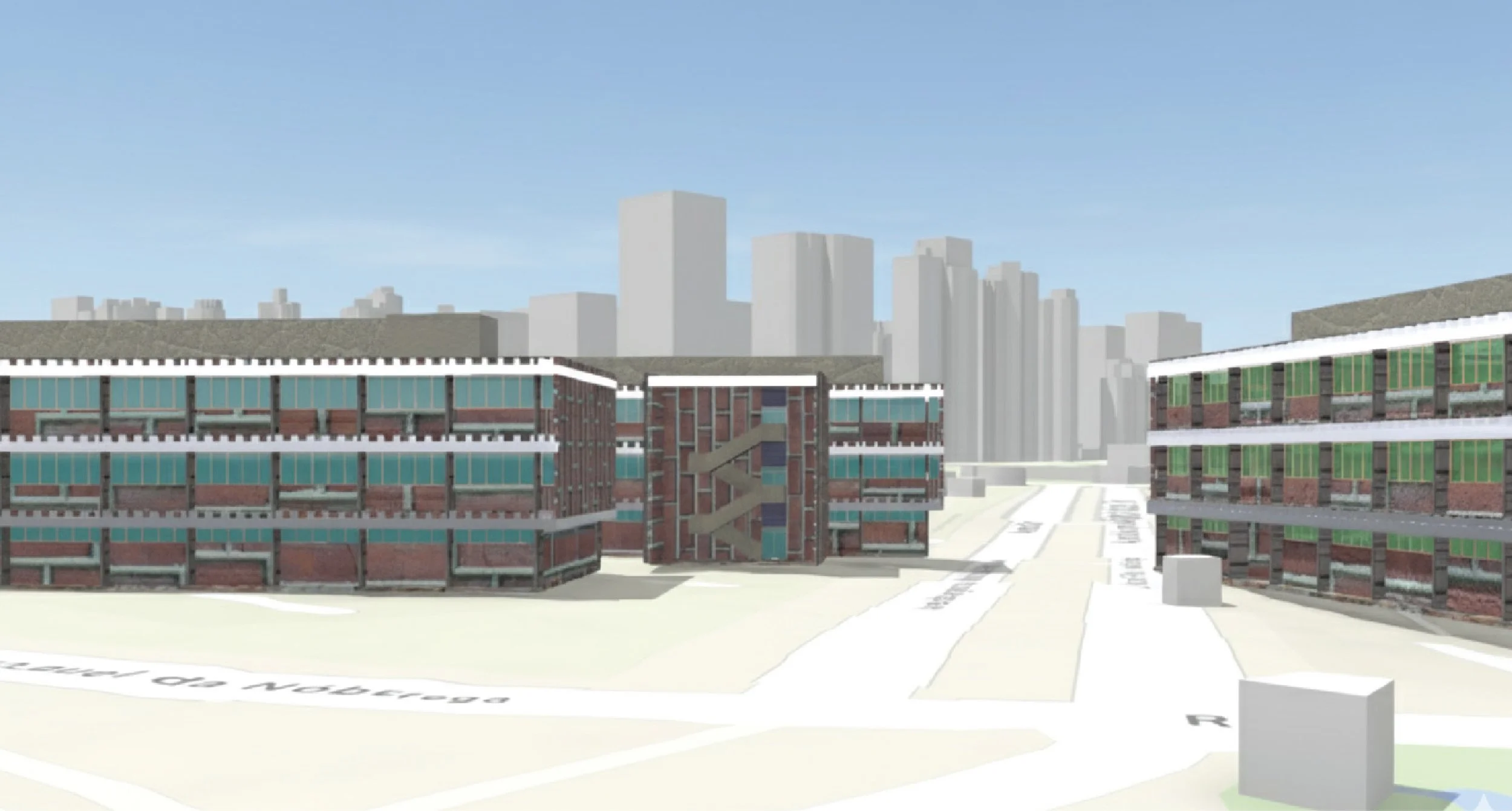
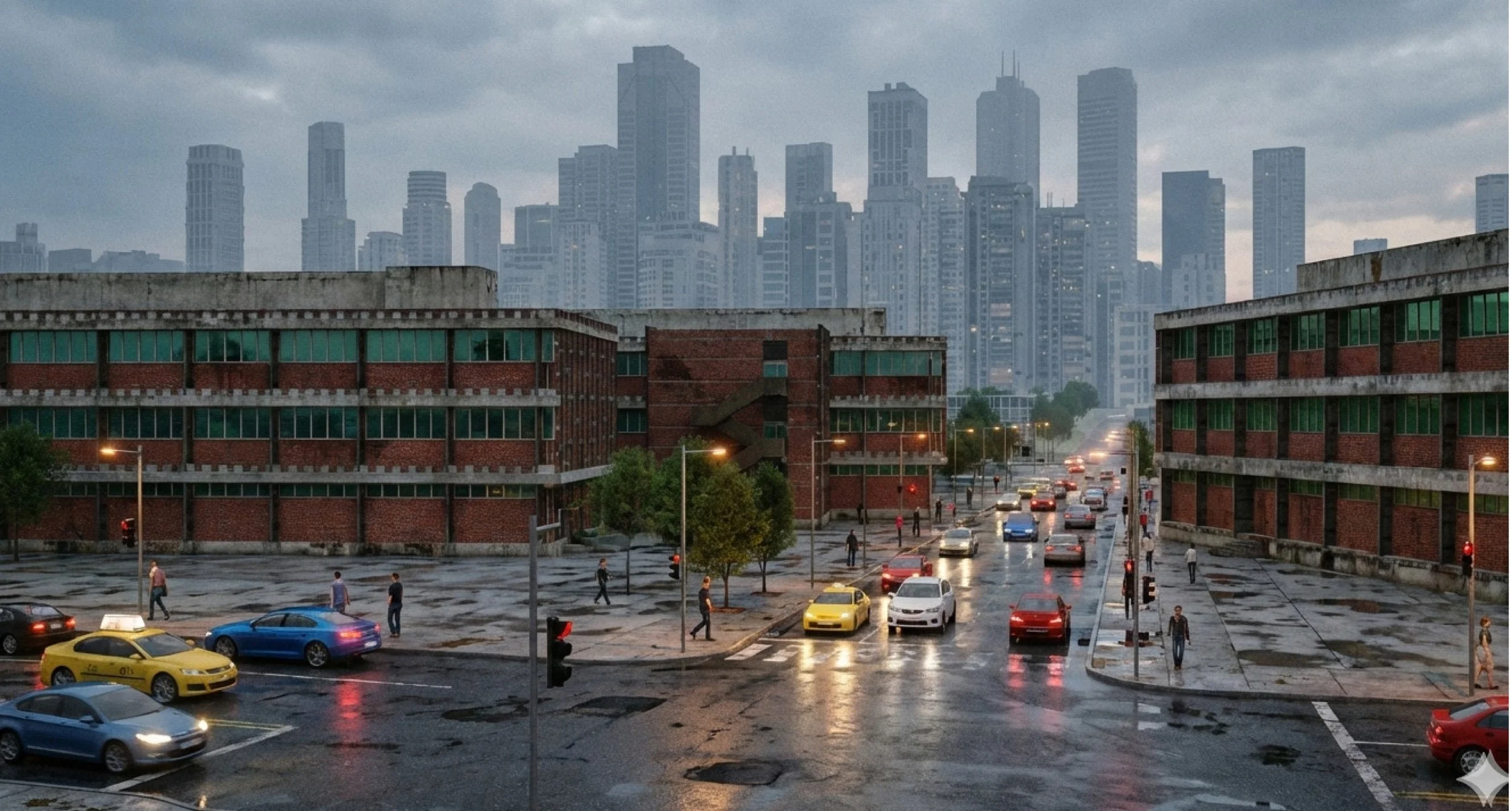
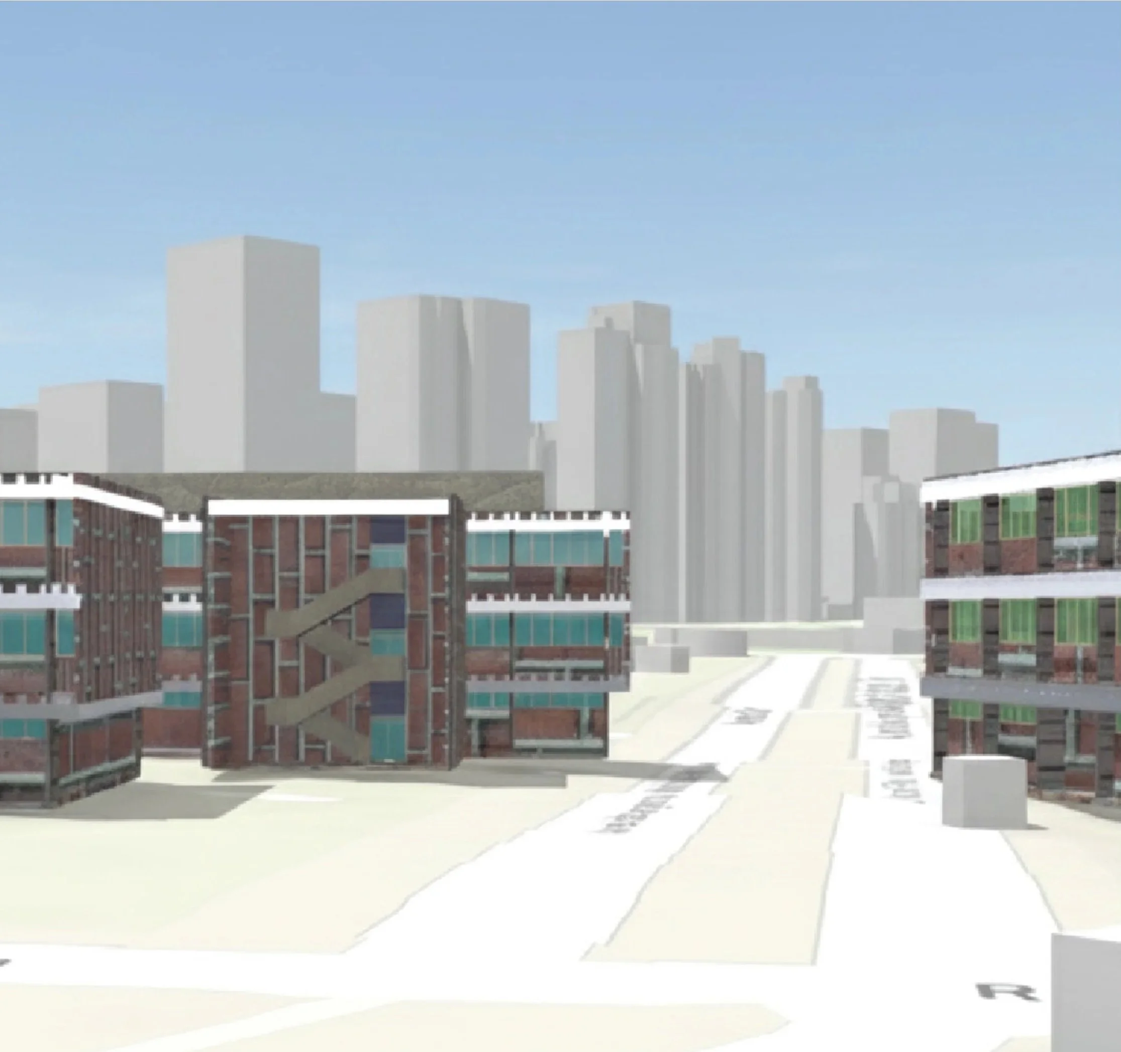
Architects can use our program to situate building designs within larger contexts, helping others assess broader spatial, functional, and visual impacts. Planners can incorporate individual building models into planning processes, gaining more detailed information about built conditions in surrounding areas being planned, such as buildings adjacent to proposed roads, infrastructure upgrades, or land-use changes. The workflow has additional potential: engineers can use the optimized files for rapid analysis, fabrication managers can generate instant 3D prints, and VR/AR specialists can employ the meshes for immersive visualization. Nevertheless, limitations remain. The ArcGIS Scene Viewer sometimes loads transparency, detailed render maps, and rich material definitions slowly or with downgraded visuals. Future developments in WebGIS visualization engines could address these issues by improving texture handling, shader compatibility, and real-time rendering performance. The neutral canvas has potential that enables AI tools to add photorealistic materials, lighting, and environmental context (Fig. 4).
Looking ahead, the proposed workflow can be extended to include automated material assignment for untextured geometry, reducing manual effort and enriching semantic accuracy. Likewise, future development can prioritize cloud-based collaboration, enabling multiple stakeholders to annotate, adjust, and validate models in real time.
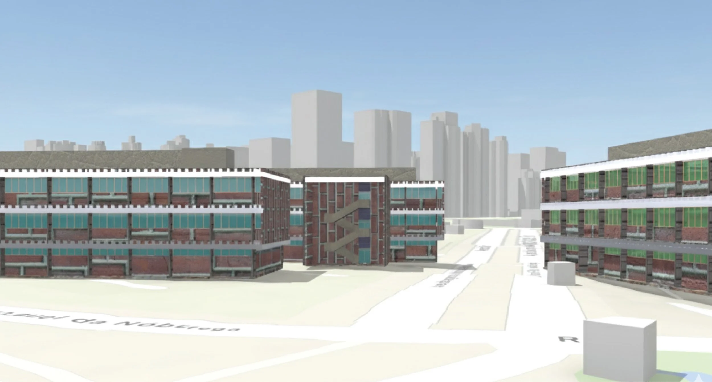
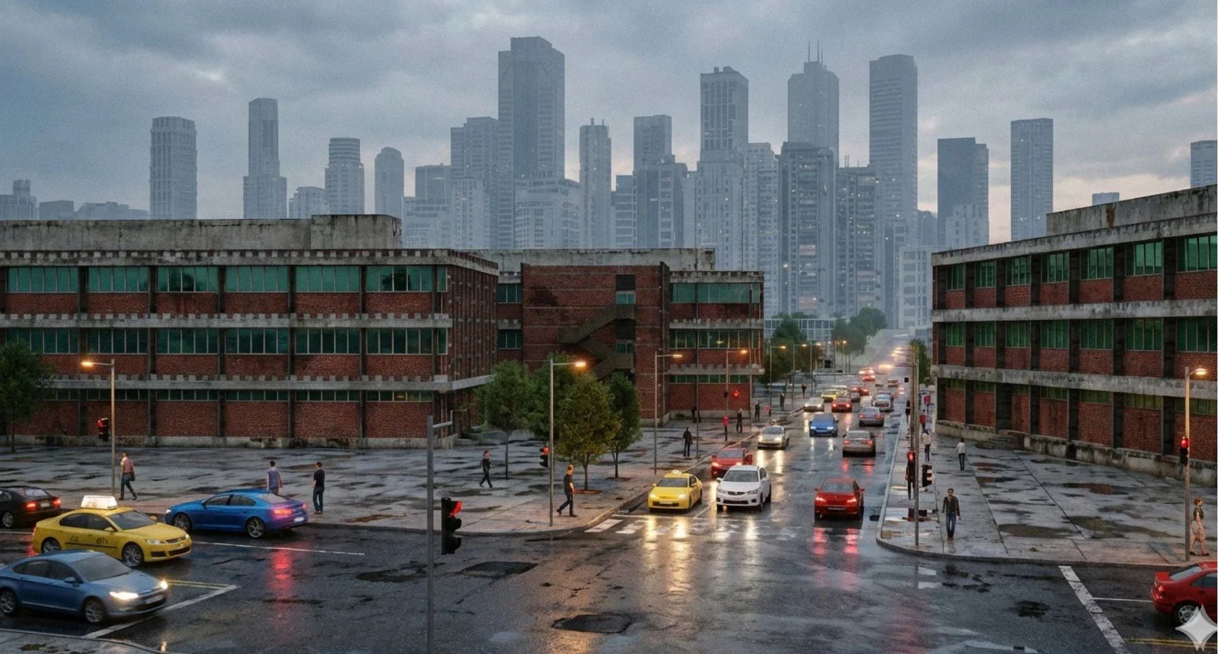
FIGURE 4: ArcGIS Scene Viewer (upper figure) versus rendered with Nano Banana (lower figure)
Gallery